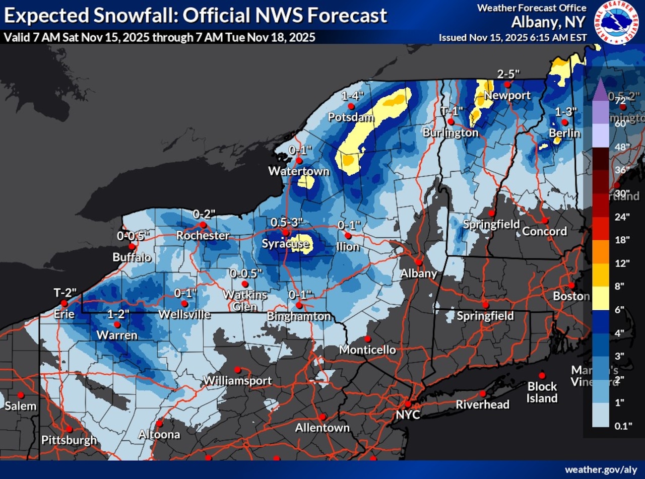
Syracuse, N.Y. -- Upstate New York could see another round of lake effect snow and strong winds starting Sunday afternoon.
The National Weather Service forecast calls for 1 to 3 inches of snow across much of Upstate, with pockets up to 6 inches or more on the Tug Hill Plateau and the hills south of Syracuse.
“Bands of lake effect snow are expected to develop Sunday into early next week,” the weather service said in issuing a hazardous weather outlook. “While there remains some uncertainty with the placement of the bands, the snow combined with gusty winds that are expected Sunday into Sunday night can lead to reduced visibility and slow travel.”
Winds from the northwest are expected to accelerate Saturday night and reach gusts of 30 to 40 mph Sunday afternoon through Monday morning. Temperatures will plunge from the low 50s today to the low 30s by Sunday afternoon.
The wind chills will drop into the mid 20s.
The storm that started last Sunday dropped more than 10 inches of snow in parts of Upstate New York, particularly in Oswego and northern Onondaga County.